Your Project
The detailed ESC Plan
The Erosion and Sediment Control (ESC) Plan summarises the needs of your site and project and describes the erosion and sediment control tools you will apply. It is ultimately the tool that makes sure that all the elements identified in the site assessment and construction methodology are worked through and managed accordingly. The initial version of your ESC Plan was important for the consent application, but once the project is running, you will need to actively and regularly communicate the detailed version of your ESC Plan to all contractors working on the project and visitors to the site, and also to your stakeholders. Your plan will include both written and visual information.
What written information should the plan include?
- Site description
- The plan needs a written site description to accompany the various plans, pictures, diagrams and photos included
- Describe the whole site, including soil type/s.
- Programme of works (this is a collection of detailed information) It needs to include:
- Dates and time frames of all the phases of the project.
- The volume of proposed earthworks.
- Description of the methodologies at each phase.
- Descriptions of the erosion control tools and the sediment control tools at each phase.
- Details of any staging plans for disturbed areas.
- The total area of bare ground on site (cumulative total through development period). The area of disturbance at each stage, including consideration of progressive stabilisation and minimisation of exposed soil.
- Details of the receiving environment that the project drains into and the pathways and distance to these Length of exposed roads, tracks and trenches.
- Cut/fill volume details.
- Location and volume details of any stockpiles.
- Extent and type of vegetation to be removed or planted.
- Inspection and monitoring programme:
- The inspection and monitoring programme identifies all the ESC tools in place and how they will be monitored.
- It details the frequency and methodology of how they will be checked, including who is responsible for doing this, and how the findings are recorded, reported and assessed. This includes checks that will be needed during rainfall events, and to accommodate any times that the site will be unattended, including a weekend.
- It is essential that your inspection and monitoring system is good enough to pick up any potential issues, and to communicate these to the relevant people who can act on them quickly.
- Emergency procedures
- All staff need to know in advance the emergency procedures that will be implemented for any accident, including spills and accidental untreated sediment discharge reaching surface water.
What visual information should the plan show?
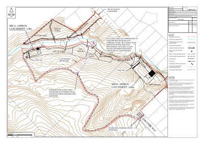
- A title, date, drawing reference number, north arrow, scale and legend
- A site plan, with accompanying diagrams, photos and pictures as necessary
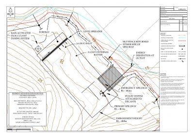
- A unique identifier for each ESC control structure
- The areal extent of soil disturbance (earthworks’ footprint)
- The location of ESC devices, including volumes and dimensions where relevant
- The location of topsoil stockpiles
- Contributing catchments for each ESC device
- Identification of any ‘no go’ or buffer areas to maintain on the site
- Clearly marked areas of cut and fill (eg, zero cut to fill line), including any soil disposal areas
- Arrows depicting the general flow path/direction of water within each catchment
- All watercourses and/or overland flow paths
- Historical/cultural/natural heritage sites
- Site entrance ways
- Pond dimensions
- The site boundaries
- Contour lines – both within and around the site
- Staging (if applicable)
- High risk areas (if applicable)
- Aerial image (if available and clear without affecting readability of drawing).

